Monitoring of Activities in Large Construction projects
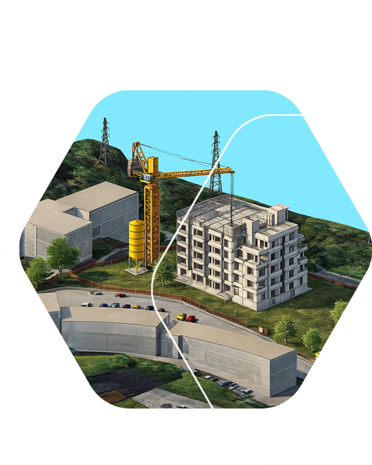
MALCO is an innovative GNSS-powered solution designed to transform the way construction sites are monitored, managed, and safeguarded.
By seamlessly integrating drones, GNSS, GIS, BIM, and real-time PNT, MALCO delivers a unified intelligent platform that enhances efficiency, strengthens safety, and optimizes performance at every stage of the construction sites lifecycle.
Using drone-mounted LiDAR, MALCO generates high-resolution scans that are transformed into detailed point clouds. These become the backbone of a dynamic Building Information Model (BIM), giving project managers an accurate, real-time view of site conditions.
At its core, MALCO leverages GNSS to ensure smooth collaboration between all technologies involved, enhancing worker and machine safety while providing actionable insights into project progress.
6
Key components that the MALCO system includes
①
GNSS-based tracking for workers and equipment, ensuring precise positioning throughout the worksite.
②
Advanced risk-monitoring software that combines GIS with high-precision GNSS to assess individual and site-wide safety risks.
③
GNSS reference stations (GPS, GLONASS, Galileo, etc.) supporting DGNSS and RTK corrections for centimeter-level accuracy.
④
Smart drones equipped with high-precision positioning and powerful data processing capabilities
⑤
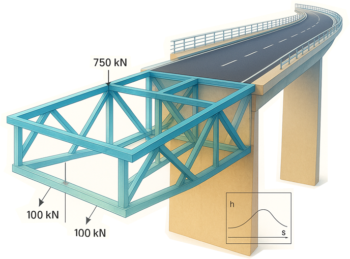
BIM management tools compare real-time drone data with the BIM models to easily identify deviations, supporting timely interventions.
⑥
Interferometric analysis tools to monitor and assess the impact of construction activities on the surrounding environment.
With high-precision RTK GNSS tracking, MALCO ensures exact worker and asset localization—critical for enforcing restricted zones and maintaining safe distances from heavy machinery. Real-time alerts notify teams of emerging risks or incidents, enabling faster emergency response and minimizing potential harm.
Beyond safety, MALCO helps keep projects on schedule.
The system instantly flags deviations from planned resource allocation—providing early insight into potential delays, long before traditional drone surveys or ground sensors would detect them.
By unifying real-time positioning, safety monitoring, and project management, MALCO introduces a breakthrough level of intelligence and automation into the construction industry—bringing smarter, safer, and more efficient worksites within reach.

From Data to Decisions:
The Power of an Integrated Platform
MALCO is redefining the future of aerial monitoring with a cutting-edge Platform-as-a-Service model. Instead of the traditional cost-per-device approach, we deliver a fully integrated service designed around real customer needs. Our platform seamlessly connects every component—drones, ground stations, tracking systems, and more—into one powerful ecosystem. The result is a complete, turnkey solution that provides reliable data, actionable insights, and end-to-end operational efficiency. In a market fragmented by providers offering only niche or partial solutions, MALCO stands apart. While many competitors focus solely on drone manufacturing or isolated monitoring services, we offer a unified, fully scalable platform that covers the entire value chain. This means our clients benefit from a comprehensive service package that ensures quality, consistency, and performance at every step.
MALCO in Action:
3 Steps to a Safer, More Efficient Workplace
1.
Keep everyone safe: Track workers and machinery, enforce restricted zones, and maintain safe distances from hazards.
2.
React instantly: Deliver real-time alerts to warn of risks and enable faster rescue responses, reducing the impact of accidents.
3.
Stay on track: To help prevent delays and keep projects running smoothly monitoring deviation from the original workplan.
Maximazing Technology
through seamless integration
The efficiency of MALCO comes from its carefully and precisely integrated technological components, designed to work together seamlessly and extract the maximum potential from every technology employed, ensuring optimal performance across the entire system.
Drones take MALCO to new heights, delivering high-resolution imagery and real-time video for inspections, progress tracking, and topographical mapping. Equipped with advanced GIS sensors, they capture critical data for environmental monitoring, disaster response, and public safety—boosting efficiency, reducing manual inspections in hazardous areas, and keeping projects safe and on track.
GNSS technology powers MALCO with high accuracy positioning, enabling precise surveying, IoT devices tracking, and design alignment. By reducing errors, minimizing material waste, and boosting machine utilization, it streamlines construction workflows, cuts costs, and enhances efficiency.
BIM transforms construction management by turning 3D models into dynamic, real-time tools. It boosts collaboration, streamlines workflows, and helps constructors predict challenges, optimize resources, and make smarter decisions. By integrating spatial data, BIM not only improves efficiency but also drives sustainability across every project.
GIS technology powers MALCO by turning spatial data into actionable insights. From construction monitoring and risk assessments like fire simulations and flood management, to terrain analysis and resource planning for public infrastructure, GIS integrates drones, remote sensing, and analytics to give a complete, real-time view of every project site.
MALCO
Smarter. Safer. More Efficient.
Seamless Operation & Security
• Minimizes errors and communication interference for uninterrupted workflow
• Secure, role-based access across local, remote, desktop, and mobile platforms
Intuitive & User-Friendly
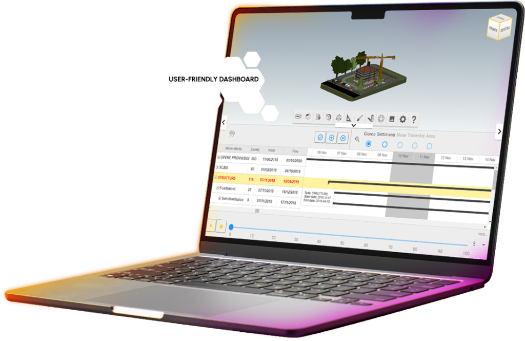
• Easy-to-use dashboards and tools for consultation, configuration, and management
• Simple setup, installation, and training with full documentation
Advanced Sensor Technology
• Comfortable wearable devices with 8+ hours of continuous operation
• Real-time 3D positioning with sub-meter accuracy for workers and assets
• Rapid detection and alerts for emergencies, intrusions, and hazard
Project Insight & Management
• Tracks site times, costs, and work efficiency • Dashboards with GANTT views and BIM integration
• Indicators for project progress and scheduling support
Project Insight & Management
• Supports environmental and safety regulation compliance
• Real-time monitoring of site stability and risk areas
• Immediate alerts for incidents and “man down” situation
Reliability & Future-Proof Design
• Robust IP64 hardware ensuring reliable communication
• Failover mechanisms for energy and data transmission
• Scalable and expandable for future technology integration
MALCO and the NAVISP Element 2 Programme
The MALCO solution for monitoring large construction sites was developed through the collaboration of several companies, each a leader in its field of strategic technologies. Together, they created an integrated system designed to tackle the diverse monitoring challenges faced by medium and large-scale construction projects.
With the support of the European Space Agency’s NAVISP Element 2 programme, this innovative idea was transformed into a concrete technology development project. All system components and subcomponents were thoroughly tested and validated, enabling the launch of an operational service supported by a solid commercialization model.
About NAVISP Element 2
The Navigation Innovation and Support Programme (NAVISP) is the European Space Agency’s initiative to drive innovation and strengthen the global competitiveness of European industry in Positioning, Navigation and Timing (PNT). Element 2 specifically supports industry-led innovation by helping mitigate technological, market, and regulatory risks. For more information, visit https://navisp.esa.int